ISLAND LANDSCAPES & GEOGRAPHY
Glacial scours, tectonic rift basalts, blanket peat bogs, and vertical sea cliffs characterize North Atlantic islands. Severe wind shears and salt spray prevent true forest formation.
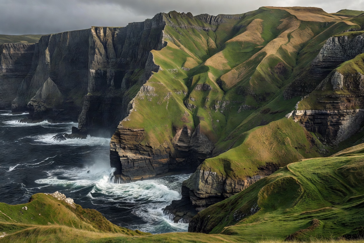
Volcanic vs. Glacial Origins
North Atlantic island terrain is produced by two primary geological engines: deep-mantle volcanism and Pleistocene ice-sheet scouring. The Faroe Islands and Iceland's outlying archipelagos are built of thick, sub-horizontal flood basalts erupted during the opening of the northeast Atlantic Ocean roughly 55 to 60 million years ago. These lavas formed alternating strata of hard basalt and softer tuffaceous sediments.
In contrast, islands like the Outer Hebrides of Scotland or the Lofoten archipelago in Norway consist of ancient crystalline basement rocks. Lewisian gneiss in the Hebrides ranks among the oldest exposed rocks in Europe, exceeding 2.5 billion years in age. Repeated glacial advances stripped topsoil down to bare rock, leaving thousands of small, scoured bedrock hollows known as "cnoc and lochan" topography.
Sea Cliffs, Stacks, and Marine Erosion
Marine erosion along the North Atlantic margin is among the most intense on Earth. Swell energy driven by continuous westerlies batters coastal faces with dynamic pressures exceeding 30 tonnes per square meter during peak storms. This forces water and compressed air into geological joint lines.
The resulting landforms are dramatic and abrupt:
- Vertical Palisades: Sea cliffs reaching from 200m to over 700m sheer elevation, such as Enniberg in the Faroes or Conachair on St Kilda.
- Detached Marine Stacks (Geo and Drang): Vertical spires left isolated as surrounding caves and arches collapse under wave impact.
- Submerged Skerries: Low-profile reefs just below the waterline that produce violent breakers and make navigation hazardous.
Peat Soils and Moorland Vegetation
High moisture levels, cool summer temperatures, and poor drainage inhibit bacterial breakdown of plant material. As a result, dense blanket peat covers expansive plateaus. Peat layers often exceed 2 to 4 meters in depth, storing enormous volumes of water and creating waterlogged upland walking conditions.
Native tree growth is almost entirely absent. The limiting factor is not winter minimum temperatures, but severe maritime wind velocity and constant airborne salt deposition. Vegetation consists of dwarf shrub heath, crowberry, heather, moss campion, sedges, and acid-tolerant grasses. Agricultural use is restricted to unimproved sheep grazing in rough pasture.
Landscape Classification Breakdown
| Landscape Domain | Dominant Terrain Form | Substrate Stability | Walking Hazard Level |
|---|---|---|---|
| Basalt Sea Cliffs | Vertical stepped trap rock | Loose scree / rockfall | Extreme (Sheer drop-offs) |
| Glacial Gneiss Uplands | Bare rock knolls & bog holes | Solid bedrock base | Moderate (Slippery, poor pathing) |
| Coastal Machair / Dune | Calcareous shell sand turf | Wind-eroded sand fringes | Low (Firm turf) |
| Upland Peat Plateau | Waterlogged blanket bog | Unstable saturated organic | Moderate (Bogs, navigation loss) |
Fjords, Sounds, and Tidal Races
Glacial troughs drowned by sea-level rise form deep fjords that cut deeply into island massifs. These waterways provide shelter from open-ocean rollers, but they also create severe funneling effects for localized wind gusts known as katabatic squalls.
Narrow channels between islands generate dangerous tidal races. When massive ocean tides squeeze through constrictions, currents frequently reach 6 to 10 knots. Tidal overfalls create standing waves and whirlpools that smaller vessels cannot safely traverse without precise slack-water timing.
Good For
- Observing primary geological structures without tree cover obstruction.
- Studying extreme marine cliff geomorphology and active wave erosion.
- Expansive wilderness navigation across peat moorland and tundra turf.
- Deep ocean fjord photography and coastal bird colony observation.
What To Know
- Unmarked cliff edges are prone to sudden turf slumping and collapse.
- Saturated peat makes cross-country foot travel very slow (often under 2 km/h).
- Dense sea fog can reduce visibility to 10 meters in less than 15 minutes.
- Drinking water from upland streams requires filtration due to sheep grazing.