NORTH ATLANTIC ISLANDS
Smaller islands between 48°N and 66°N form distinct archipelago chains. They are shaped by ocean swell, subpolar maritime gales, and profound physical isolation.
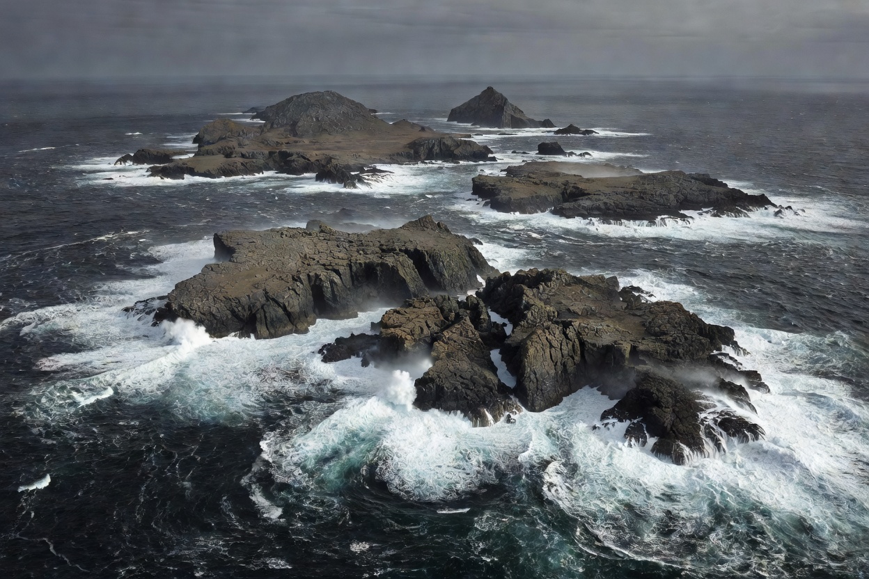
What Defines a Smaller North Atlantic Island
Smaller North Atlantic islands are landmasses isolated by open deep-ocean waters rather than sheltered inner sounds. Surface areas generally range between 5 and 1,500 square kilometers. Tree canopy is almost zero. Winds regularly prevent arboreal growth. Ocean surges govern shoreline stability.
These landmasses do not have continuous overland connections to continental energy, food, or road systems. Everything arrives by roll-on vessel or small utility aircraft. When autumn gales begin, harbors often close for 48 to 96 hours at a time.
Geographic Distribution & Basement Types
The islands divide into two primary structural categories based on bedrock origin:
- Precambrian Basement Archetypes: Outer Hebrides and parts of coastal northwestern Norway. Formed of Lewisian gneiss and granite. Highly resistant to wave erosion, showing rounded glaciated knolls, acidic bog hollows, and white shell-sand beaches.
- Paleogene and Recent Volcanic Archetypes: The Faroe Islands, Iceland's Vestmannaeyjar group, and Jan Mayen. Formed by basalt lava flow sheets. Highly layered, characterized by stepped trap-rock cliffs, dramatic marine pillars, and rapid coastal erosion.
Exposed vs. Sheltered Coastal Dynamics
Atlantic-facing coasts absorb uninterrupted ocean swells generated across thousands of kilometers of open sea. Breakers frequently reach heights over 10 meters during winter storms. Wave action carves sea caves, blowholes, and detached stacks.
Inward-facing sounds or leeward bays provide the only viable anchorages. Consequently, human settlements are strictly concentrated on the leeward sides of islands. Even minor differences in coastal orientation determine whether a community can maintain year-round boat landings.
Settlement Density and Maritime Dependency
Human populations on these smaller islands rarely exceed 2,000 residents per island, outside of regional hubs. Most harbor settlements contain between 80 and 600 people. Economic life centers on demersal and pelagic fishing, fish farming installations in deep fjords, and seasonal sheep grazing on unimproved moorland.
Younger demographics often migrate to mainland educational centers, creating fluctuating seasonal populations. Summer doubles or triples the local headcount with returning seasonal workers and self-contained travelers.
Key Operational Comparisons
| Island Group | Mean Max Elevation | Bedrock Type | Dominant Winter Wind |
|---|---|---|---|
| Outer Hebrides | 799 m (Clisham) | Lewisian Gneiss | Southwest to West |
| Faroe Islands | 880 m (Slættaratindur) | Layered Basalt | Southwest / Variable Gale |
| Vestmannaeyjar | 283 m (Heimaey) | Recent Basaltic Tuff | East to Southeast |
| Røst / Værøy | 450 m (Værøy) | Granitic Gneiss | West to Northwest |
Transport Fragility and Seasonal Transitions
Ferry transit is the lifeline. Ro-Pax vessels designed for heavy sea conditions operate scheduled sailings, but roll thresholds and port entry conditions dictate cancellations. Short Takeoff and Landing (STOL) airfields operate with 19-seat aircraft or utility helicopters. Low cloud ceilings and crosswinds regularly delay air transits.
Between May and August, daylight extends up to 20 hours per day, sea conditions moderate, and regular ferry timetables operate. From November through March, daylight shrinks to 4 to 6 hours, swell heights peak, and transport schedules contract to bare subsistence frequencies.
Good For
- Severe, dramatic open-ocean landscapes without commercial clutter.
- Observation of intact seabird nesting colonies (puffins, fulmars, gannets).
- Direct insight into high-latitude maritime subsistence and self-reliance.
- Uncrowded coastal walking routes and geological study.
What To Know
- Zero guarantee of strict travel schedules; weather buffers are mandatory.
- Very limited commercial dining or lodging facilities outside summer.
- High variable costs for short-distance vehicle transport.
- Rugged terrain without guard rails, requiring self-sufficient safety planning.